
What if you could see through the timber and underbrush of a potential investment property before you even step foot on the dirt? You’ve likely felt that familiar knot in your stomach when a fence line disappears into a creek bed, leaving you wondering if you’re standing on your own ground or trespassing on a neighbor’s. It’s equally frustrating to stare at a flat, 2D map and try to guess if a ridge is a gentle slope or a sheer cliff that makes a property inaccessible. We understand that for a land buyer or a serious hunter, these aren’t just technical hurdles; they’re risks to your reputation and your wallet.
In this article, you’ll learn how to leverage advanced online mapping tools for property lines and topography OnX maps to eliminate that guesswork and verify real-world land value with surgical precision. We’ll show you how to utilize Elite-tier features like Lidar imagery to pinpoint trophy buck bedding areas and verify legal access points before you ever drive to the gate. We’re going to break down the specific layers and tools you need to move from broad scouting to pinpointing the exact attributes that make a piece of ground a high-value legacy property.
Key Takeaways
- Safeguard your land investment by integrating County GIS data to establish precise boundaries and prevent costly trespassing disputes.
- Leverage online mapping tools for property lines and topography OnX maps to transform flat 2D data into high-resolution 3D visualizations of complex terrain.
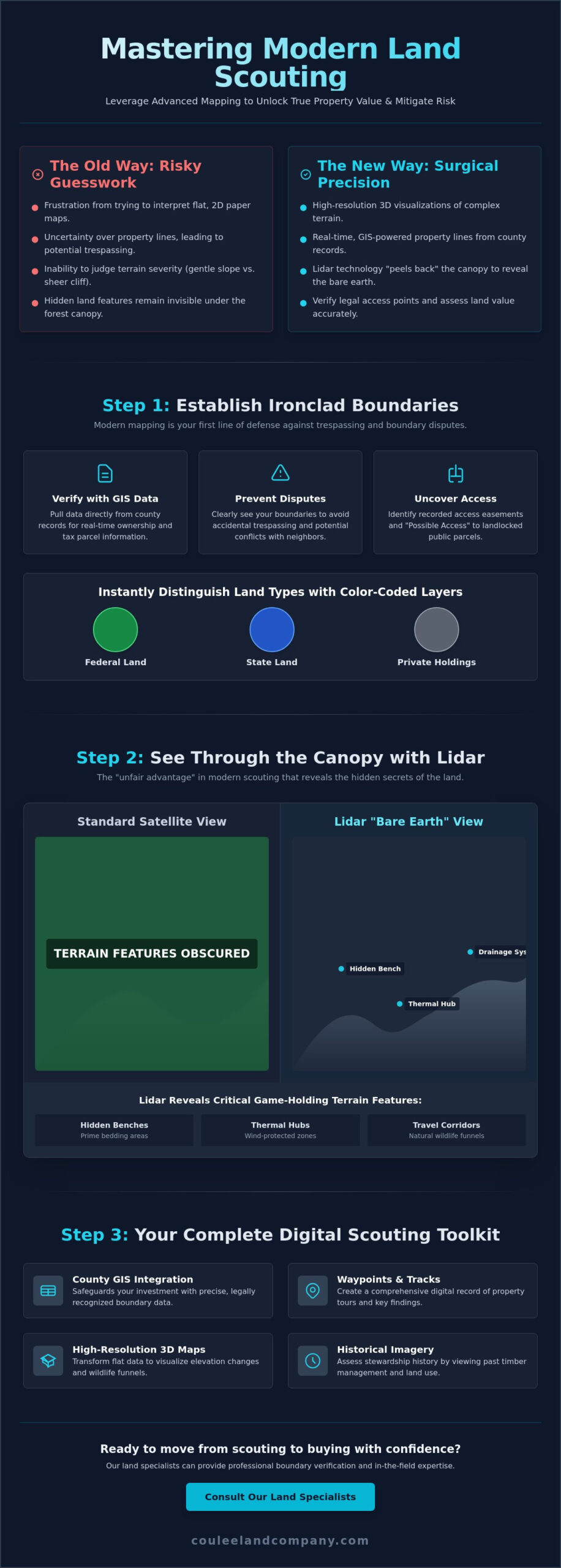
- Utilize Lidar technology to “peel back” the forest canopy and identify hidden benches and thermal hubs that are invisible to the naked eye.
- Assess the stewardship history of a property by examining historical imagery to identify previous timber management and significant land-use changes.
- Use digital Waypoints and Tracks to create a comprehensive record of your property tours, ensuring seamless data sharing with your land brokerage team.
Navigating Property Lines with Precision Mapping Tools
Knowing exactly where your boots are on the ground is the bedrock of responsible land ownership and ethical hunting. Modern mapping technology has replaced the guesswork of folded paper maps with high-precision digital layers. These tools rely on a sophisticated Geographic Information System (GIS) to pull data directly from county records, providing real-time updates on ownership and boundary lines.
Using online mapping tools for property lines and topography OnX maps allows you to see the landscape as a legal grid. This isn’t just about convenience; it’s your first line of defense against accidental trespassing and potential boundary disputes with neighbors. By viewing tax parcel information, you can identify neighboring landowners and uncover recorded access easements that might not be visible from the road. This level of detail is vital when assessing the true value and utility of a tract of land.
To better understand how these digital layers translate to the field, watch this helpful video:
Public vs. Private Land Boundaries
The power of these tools lies in their visual clarity. Color-coded layers immediately distinguish between State land, Federal land, and private holdings, which is crucial when navigating the diverse terrain of Western Wisconsin. We often look for the “Possible Access” layer to find landlocked public parcels. These hidden gems are often overlooked by the general public but offer incredible opportunities for those who know how to navigate the legal requirements of access.
Verifying Boundaries for Land Buyers
Digital lines are incredibly accurate, but they should always be cross-referenced with physical evidence on the ground. When we tour a property, we look for old fence lines, blazed trees, or survey stakes to confirm what the app is telling us. It’s a pragmatic approach that combines tech with old-school woodsman skills. If you’re ready to walk a potential investment, you should consult our land specialists for professional boundary verification during a showing. This diligence ensures you maintain boundary awareness even in remote areas where cell service fails, provided you’ve downloaded your offline maps in advance.
Analyzing Topography and Lidar for Bluff Country Scouting
Topographic mapping has evolved significantly from the standard 24k USGS quads that hunters relied on for decades. While those paper maps provided a baseline, they lacked the detail needed to identify the subtle terrain features that hold mature bucks. Modern online mapping tools for property lines and topography OnX maps now offer high-resolution 3D rendering, allowing you to rotate the landscape and visualize elevation changes before you ever leave your home. This technology is especially critical in the “Bluff Country” of Western Wisconsin, where steep elevation changes create natural funnels that dictate wildlife movement.
The real “unfair advantage” in modern scouting is Lidar imagery. This technology allows you to virtually strip away the leaves and timber to reveal the bare earth underneath. According to this USGS explanation of Lidar data, these laser-measured models provide an incredibly precise look at elevation. By toggling these layers, you can identify hidden benches, thermal hubs, and narrow drainage systems that serve as primary travel corridors in steep country. These are the spots where trophy whitetails bed and travel, often completely hidden from standard satellite views.
Decoding Lidar and 3D Layers
To find micro-topography like small ridges or hidden wallows, simply toggle the Lidar overlay in your map settings. This layer highlights the smallest vertical changes that often go unnoticed on standard topo maps. When you combine this with the 3D exaggeration tool, you can visualize how wind and thermals will flow through a valley. It’s a critical step for anyone looking to pattern whitetails in rugged terrain. If you’re looking for specific tactical advice on using these features, see our guide on scouting for deer in hills.
Terrain Features That Drive Property Value
Steep terrain is often labeled as “unbuildable,” but for a land investor, this ground is gold. These vertical slopes create natural sanctuaries where deer feel safe from human pressure, effectively increasing the holding capacity of the land. We use these maps to identify potential locations for food plots on flat ridge tops or secluded cabin sites with a view. If you’re searching for your own piece of paradise, exploring our current hunting properties is a great way to see these terrain features in action. This data-driven approach ensures you’re investing in land with high biological and recreational value.
Integrating Mapping Data Into Your Land Purchase Decision
The transition from scouting a property to signing a purchase agreement requires a shift from curiosity to clinical analysis. High-performing online mapping tools for property lines and topography OnX maps serve as your primary due diligence instruments during this phase. By using “Waypoints” and “Tracks,” you can create a digital breadcrumb trail during a property tour, marking specific features like hidden springs, stand sites, or potential building locations. This data isn’t just for your personal records; it’s a vital communication tool that allows you to share precise findings with your broker to ensure everyone is looking at the same high-value attributes.
Historical imagery layers provide a window into the land’s past, revealing previous timber harvests or shifts in agricultural use that aren’t apparent today. We use these tools to calculate the exact acreage of tillable land versus timber, which is essential for determining an accurate market valuation. A specialized expert like Mike Law leverages this data to identify “diamond in the rough” properties that others overlook because they can’t see the underlying potential through the brush. This pragmatic, data-driven approach turns a speculative walk in the woods into a confident investment strategy.
Remote Scouting Before the Showing
Efficiency is key when searching for a legacy property. You can build a digital “hit list” by filtering for specific parcel sizes and terrain features before you ever burn a gallon of diesel. Satellite imagery allows you to identify critical neighboring food sources and water holes that will dictate game movement on your side of the fence. This high-level view ensures that every property you visit already meets your baseline criteria for success.
From Digital Map to Closing Table
As you move toward a closing, your mapping data becomes a roadmap for professional surveyors and title insurance providers. Having a clear understanding of boundaries and easements through digital tools streamlines the verification process and reduces the likelihood of surprises at the 11th hour. If you’re ready to put these tools to work, see our latest hunting properties for sale to start your digital scouting journey today. We’re here to help you translate digital data into real-world land ownership.
Take Command of Your Next Land Investment
Mastering the landscape requires more than just a pair of boots; it demands the right digital arsenal. You’ve seen how integrating GIS data and Lidar imagery can transform a simple scouting trip into a surgical evaluation of a property’s true potential. By leveraging online mapping tools for property lines and topography OnX maps, you’ve moved beyond the uncertainty of vague boundaries and into the realm of data-driven land ownership. You now have the ability to identify hidden bedding benches and calculate tillable acreage with absolute confidence.
When you’re ready to apply these insights to the field, partner with a team that lives and breathes this dirt. We bring over 20 years of experience in Western Wisconsin land brokerage to every showing. Our specialists, including industry leaders like Bryan Lemke, understand the unique nuances of Buffalo County, the undisputed #1 destination for trophy whitetails. Don’t leave your legacy to chance when you can rely on proven regional expertise.
View Our Exclusive Bluff Country Listings and start your journey toward owning a piece of this premier landscape today. Your dream property is waiting for a buyer who knows exactly what they’re looking at.
Frequently Asked Questions
How accurate are onX property lines for legal purposes?
Digital property lines are highly precise for field navigation, but they aren’t a legal substitute for a professional land survey. These tools aggregate data from County GIS records to provide a reliable visual representation of boundaries. While they’re indispensable for day to day scouting and identifying general fence lines, you should always refer to a certified survey for legal disputes or permanent construction projects.
Can I use onX Maps without cell service in deep bluffs?
You can absolutely navigate deep bluffs without cell service by utilizing the Offline Maps feature. By downloading your target area in advance, your device’s internal GPS will track your location directly on the map even in total dead zones. This is a non negotiable step for anyone exploring the rugged coulees and remote ridges of Western Wisconsin where signal is often nonexistent.
What is the difference between standard topo maps and Lidar?
Standard topographic maps use contour lines to show general elevation, whereas Lidar uses laser measurements to reveal the bare earth surface. Online mapping tools for property lines and topography OnX maps leverage Lidar to virtually strip away the forest canopy. This allows you to pinpoint micro terrain features like hidden benches and drainage hubs that traditional maps simply cannot detect through the timber.
Does onX Hunt show the names of private landowners?
Yes, the platform displays the names of private landowners by pulling data directly from public tax parcel records. This transparency is vital for land buyers who need to identify neighbors or hunters seeking to contact owners for permission. You’ll often find the total acreage and the registered tax address included, which provides a clear picture of the surrounding ownership landscape before you invest.